|
SimpleMapServer:
A java OpenGIS WMS server
"tout simplement" |
Version
: |
0.712 |
From : |
29/05/2008 |
Author : |
Lavaux Gilles |
|
NEW version available: 0.712
(changes: added
WMS 1.1.0 and 1.3.0, improve cache, quantize GIFs, more info publishec
in capabilities, getFeatureInfo skeleton )
|
|
What
is it? |
- It produce geographical map images. It is (should
be) compliant with the OpenGIS WMS specification 1.0.0/1.1.0/1.1.1/1.3.0.
- It is simple to configure, it use no database.
- Learn more with the
online documentation
Note: if you are looking for a java map client, you can have
a look at the SimpleMapClient
project.
Note 2: if you want a faster map server, have a look at a friend
project 'fastMapserver'
here.
|
|
|
Status: |
- Stable |
|
|
Features: |
- Can serve raster images or vector data.
- Support shapefile (limited).
- Native raster data projection is platte-carre. If not, the server
can ONLY serve the data native projection.
- Supported re-projections: orthographic.
- Support as many layers as you like. A Layer may be composed
from several tiles, it also can have level of details (LOD).
- Layer can be RGB or indexed color.
- Supported image format: JPEG, GIF, PNG.
- It is quite fast.
- Can be used in a web-server (servlet), or embedded in a java
application.
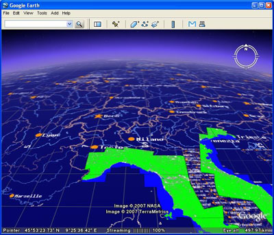
- Supports superOverlays for Google Earth client.
- Supports "virtual" layers.
- No external dependencies, don't use any jar library except log4j.jar
|
|
|
Distribution: |
- There are 3 packages, each one is a zip file:
1) the sources: you need ant do build it easily, see
the readme.txt and install.txt files.
2) the buildt web application.
3) some example layers, note that these data are not very interesting,
they have low resolution/precision. They are just here to allow
you to test your server installation.
Follow this link to the DOWNLOAD
page.
|
|
|
Documentation: |
- See these files:
REAME.TXT:
it describes the functionnalities of the server and how to configure
it.
FAQ.TXT
TROUBLESHOOTING.TXT
You can have a look at this layers
test result page. It show the map images and corresponding
URLs that I have used to test the functionnalities of the map
server. It is quite old now...
|
|
|
Known problems: |
- none that I know....
|
|
|
Major changes: |
- 0.712:
1) WMS 1.3.0 and 1.1.0, improve cache, quantize GIFs,
compress imaga data, more info in capabilities
- 0.707:
1) Change GoogleEarth module to support
superOverlays.
- 0.704:
1) Add virtual layers capability.
- 0.645:
1) Added 'doc' folder in distribution.
- 0.644:
1) Improvement of GoogleEarth servlet:
It is now able to restrict the returned area to the layer bounbary
if this one is smaller. The image width and height are also adjusted
to avoid sending oversampled data.
- 0.643:
1) Fix: orthographic projection was wrong with strange
extends.
2) Added: GoogleEarth servlet.
3) Added: 'abstract' in layer.conf, is displayed in the capabilities.
4) Added: can add a layer logo/credit.
- 0.630:
1) added 'CatalogueSingleDateIdxAddOn' catalogue plugin. Thanks
to Antoine.C. Used to publish 'dated' maps.
2) in case or vector/shapefile data: if the data file is modified,
it is automaticaly reloaded by the server. .
- 0.622:
1) added support for shapefile! Basic, tell me
if you have problems with it...
2) support data in any projection. In this case the server can
only serve in the data native projection (can not reproject).
- 0.610: first public release.
|
If you have any question or problem, fell free to drop me an email
at this address (rebuild it): gilles <DOT> lavaux <AT> serco <DOT>com
|